Barangay hazard map
Flood and fire risk overview
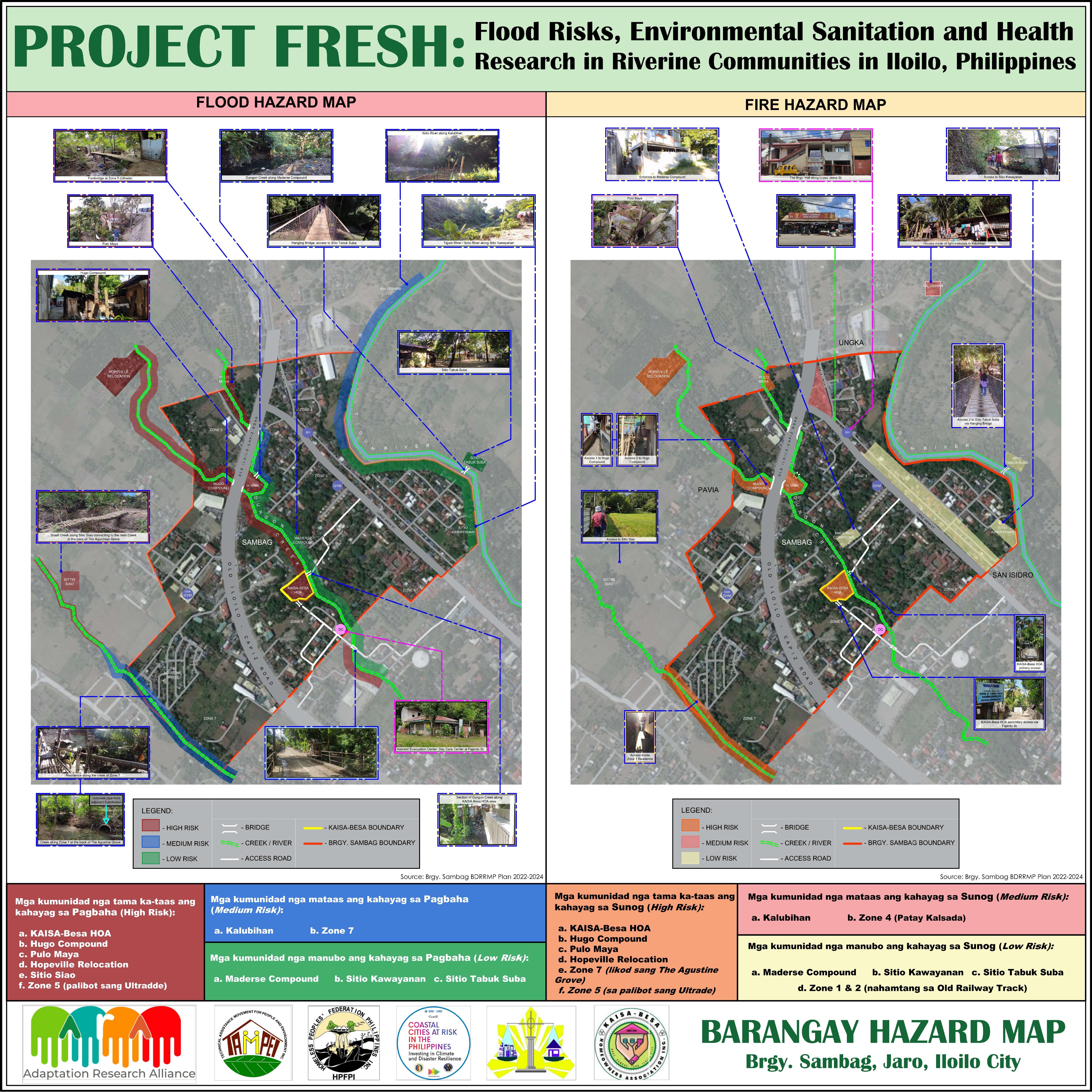
The Barangay Sambag Hazard Map provides a detailed visualisation of flood-prone and fire‑prone areas within Sambag, Jaro, Iloilo City. Based on the Barangay Disaster Risk Reduction and Management Plan (BDRRMP) 2022–2024, the map identifies communities with high, medium, and low risk levels, helping residents, planners, and emergency responders understand local vulnerabilities.
The flood hazard map highlights high‑risk zones located near major waterways such as Dungon Creek, Tigum River, and other tributaries. Areas like KAISA‑Besa HOA, Hugo Compound, Pulo Maya, Hopeville Relocation, Sitio Siao, and Zone 5 face the highest exposure due to dense housing and proximity to water bodies. Medium‑risk zones include Kalubihan and Zone 7, while Maderse Compound, Sitio Kawayanan, and Sitio Tabuk Suba are categorized as low‑risk.
The fire hazard map shows similar patterns, marking highly congested areas with light materials as the most vulnerable. High‑risk communities include KAISA‑Besa HOA, Hugo Compound, Pulo Maya, Hopeville Relocation, Zone 5 (Ultrade area), and Zone 7 behind The Augustine Grove. Medium‑risk areas include Kalubihan and Zone 4, while low‑risk zones such as Maderse Compound and Sitio Tabuk Suba have fewer structural fire hazards.
This map provides essential local risk information to support disaster preparedness, urban planning, and community resilience efforts in Barangay Sambag.
Comments
There is no contentYou must be logged in to reply.